Coumaraglin with its Bronze Age Monuments
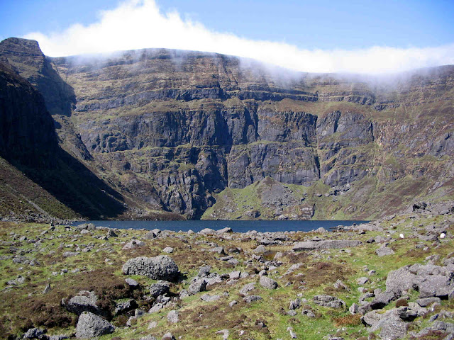
 |
| Fulacht Fia in the Upper Araglin Valley |
Where is Coumaraglin?
Coumaraglin is situated close to the small village of Kilbrien in the south-western Comeraghs. Specifically, it is the broad bowl-shaped valley that sits to the west of the southern ridge of the Comeraghs (the Monavullagh Ridge) that sweeps south from Seefin to the Mauma Road. The Araglin River, a tributary of the Colligan, rises on the southern slopes of Seefin and drains the northern part of the valley, creating a small gorge in the process, while the much smaller Monavar drains the southern part. Between the two lies the archaeologically significant Cnoicín, literally little hill.Archaeology in Waterford
 |
| Looking north-east towards Bearna an Mhadra across Coumaraglin from the cairn on Cnoicín |
Coumaraglin - Bronze Age Archaeological Complex
Archaeologists define an “archaeological complex” as a location with a number of different prehistoric monuments from a confined time period, occurring in close proximity to each other. In Coumaraglin`s case the monuments are classified as Bronze Age (dating from about 2000 B.C. to 500 B.C.). A ramble through Coumaraglin in search of these monuments is a most rewarding exercise. Not all stone configurations are easily identified as specific monuments by us amateurs, however. Still, here are five of the more "easy to recognize" monuments in the valley:
Fulacht Fia: Most archaeologists believe that a Fulacht Fia or Burnt Stone Mound developed from an early Bronze Age cooking site. A stone or wood lined trough was cut into the ground near a stream. The trough was then filled with water and stones were heated in a nearby fire before being placed in the trough to heat the water to cook the meat. The discarded stones eventually built up a horseshoe-shaped grassy mound around the trough. One of the best examples of a fulacht fia can be seen close to the Upper Araglin at S 2670 0465.
Ring Barrow: During the Bronze Age simpler forms of burials replaced the Stone Age Megalithic Tombs. The Ring Barrow was one of the most common of these, consisting of a circular shaped earthen burial mound with an external fosse (dyke) and bank. A good example can be found about 200 metres west of the fulacht fia above - cross over the ditch into a field and locate it beside some furze bushes near a field boundary on the left at S 2650 0459.
 |
| Ring Barrow located about 200 metres west of the Fulacht Fia mentioned above |
Stone Row: Prehistoric peoples are believed to have used stone rows to fix important seasonal dates in the solar calendar. Approximately 50 metres north of the ring barrow above there is an interesting stone configution at S 2647 0645. There may have been two Stone Rows here at one time, the southern one oriented in a north-west to south-east direction. This alignment pointed to the setting sun at the summer solstice and the rising sun at the winter solstice.
Cairns: Cairns are heaps of stones that usually covered prehistoric burials but sometimes they fulfilled a purely symbolic function, acting as a type of interface with the Gods. The top of Cnoicín has a few cairns e.g. at S 2574 0340.
Stone Circle: Stone Circles are considered to be Bronze Age Ritual Sites. The examples found in Waterford are more akin to the Kerb Circles found in Wales than to the Stone Circles of south-west Munster because of their smaller orthostats. One example in Coumaraglin can be seen in the small col to the east of Cnoicín at S 2608 0351.
Visiting Coumaraglin
The Mauma Road, to the south of the Monavullagh Ridge, has a few places to park that allow access on foot into the Araglin Valley about 2 kilometres to the north. Alternatively, drive west along the Mauma Road and take the first right you meet. This brings you into the heart of Coumaraglin where there is a suitable lay-by about 1.3 kilometres further on at S 258 037.Do not undertake this exploration in summer due to the bracken!


Comments
Post a Comment