A Special Comeragh Place - Glenary
 |
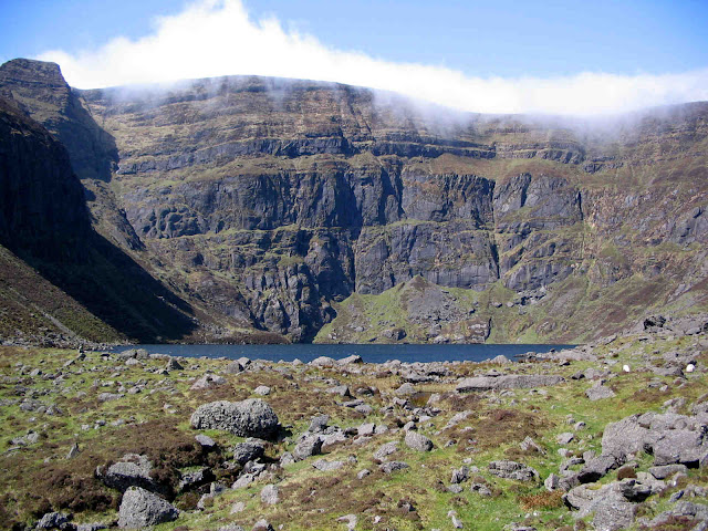
| Carey`s Castle |
Where is Glenary?
Nestled in the north-west corner of Waterford near Clonmel is Glenary, the name originating most likely from “Gleann an Aoire” – the valley of the shepherd. Canon Power thought it may have come from “Gleann Aimhréidh” meaning uneven/rough valley. Some people say the name means crooked valley, and the valley does take two very definite changes in direction. The valley, running mainly from west to east and lying between Boolabrien Ridge and Long Hill, is drained by the Glenary River which rises on the slopes of Lachtnafrankee to the east and flows west into the Suir near Kilmanahan. A little-known area this but it is well worth a visit.
Getting there
From Clonmel take the R671 towards Dungarvan. Less than 1 kilometre after the turn-off for Dungarvan take the first left and continue uphill for about a kilometre to a forest entrance on the left signposted “Carey`s Castle”. There is plenty room for parking here.
A Special Place
Some places reverberate strongly with echos from the past and Glenary is certainly one such place. First off there is the mysterious Carey`s Castle. Who was Carey? When was the castle built? And why does it have a strange mix of architectural styles – a Celtic round tower, Gothic windows, Romanesque arches, A Norman keep? Then you have Glenary Village itself, its ruined buildings shouting out cluster village or clochán. It is in fact considered the last cluster village in Waterford, finally abandoned in the mid-sixties.
Then there is the old townland name “Glenabbey”. This suggests that monks lived here for a while. The dovecote, if it is a dovecote, (stone structure in which monks kept doves) behind Carey`s Castle is another hint of monastic settlement here perhaps. Was there a connection with the 12th century Cistercian monastery of Inislounaght just 3 kilometres to the north? Was there a grange or monastic out-farm in the valley?
Finally, there is “An Staighre” (still traceable on the ground in places), the path that led across Boolabrien Ridge to the south to another cluster village in the Nire Valley, Glendalaghin, and which was used as a funerary path (Bóithrín na Sochraide) to Clonmel in bygone times. It was also the main road from the Nire into Clonmel in the 19th century.
 |
| Bottom of An Staighre Path beside the Glenary |
A Walk of Discovery
Now take the boreen on the right. Follow this for 200
metres (can be boggy in wet weather) to a junction. To continue straight on would bring you to Áth an
Bhainne, crossing point on the Glenary. (This is also known as "Bagge`s Hole", with the site of a hedge school and mill nearby.) You take the left fork however and
follow the boreen, “An Bóthar Fada” for about 600 metres. Ignore the left fork at the first ruin of Glenary cluster village. Continue on until you reach a ruin at a high gate and fence. Pause awhile amongst the tumbling stones now in the stillness of the enclosed
boreen and try to imagine families of a bygone era tilling the fields or
ferrying water from the river below.
 |
| Boreen leading to Glenary Cluster Village/Clochán |
The boreen beyond this point
has become overgrown in recent years. At this stage then it is best to turn left at the ruin
and follow the fence uphill for 50 metres to reach another high gate on a wider
track.Turn right here, carefully cross the gate and continue east
through a young forest plantation to meet yet another gate after 300 metres. 200 metres later you reach the end of the track at a
gate.
Cross the gate onto a wide track. You will be turning right
here into Russellstown Wood but first it is well worth while taking a short
detour to locate a lovely lunch spot at the junction of the Coumwhelaun and
Glenary streams. So, cross the wide track at
the gate and wander downhill on a narrow path to reach the Coumwhelaun stream. Cross it and follow a sheep path down to the right for over 100
metres to the confluence of the two streams. This is an idyllic little spot. Looking
uphill in a south-easterly direction along the Glenary towards Boolabrien Ridge can you sense
the ghosts of the past following a funeral procession down An Staighre from Glendalaghin in the
Nire on its way to Clonmel?
When refreshed, return to the wide track, turn left and walk down to the bridge across the Glenary. Now follow the forest track above the river in Russellstown Wood. After about 1.3 kilometres keep right at the path junction and 1.2 kilometres later, if water levels are low, cross the Glenary opposite Carey`s Castle, which is clearly visible through the trees. Ramble around this interesting building for a while before heading west along the main path to reach your car after 700 metres.


Comments
Post a Comment