Posts

Showing posts from June, 2021
Image
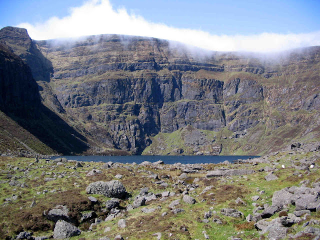
Comeragh Glacial Features  Outside of Kerry and Wicklow, the Comeraghs is one of the most spectacularly glaciated areas in Ireland. The nine square kilometre area of the Central Comeragh Plateau is encircled by no less than nine coums. Surely this makes it one of the most glaciated pieces of real estate in Ireland! Here is some information on some of the glacial features to be found on our local mountains. Dramatic View down to Coumduala from Knockanaffrin Ridge What is a “coum”?  A Coum (“com” in Irish, “corrie” or “coire” in Scots` Gaelic, “cirque” in French and “cwm” in Welsh) is the birth place of a mountain glacier (a river of ice). How old are the Comeragh coums? Hard to be definitive but, according to Frank Mitchell, one of Ireland`s leading authorities on glaciation, most of the ice sculpting was done between about 300,000 and 130,000 years ago with some reshaping in more recent times. How many coums in the Comeraghs? Debatable but there are at least 14. Here goes: Lough
Image
Geography, Geology, Geomorphology, Glaciation A Little Geography The Comeraghs stretch from the Suir Valley and Kilsheelan Woods in the north to the Mauma Road in the south, and from Ballymacarbry in the west to Mahon Bridge in the east, and cover an area of almost 200 square kilometres. They are visible from most corners of the county from Clonmel in the north west to Tramore in the south east. The mountains consist of two main ridges - the northern ridge called Knockanaffrin and the southern ridge sometimes called the Monavullagh - separated by the Central Plateau. There are some outlying hills such as Cruachán Déiseach in the south, Cruachán Paorach in the east and Lachtnafrankee in the north-west. The highest point is located on the Central Plateau a little west of Coumshingaun and is simply known as “792”. The range acts as a watershed for the surrounding catchment areas of the Suir Valley to the north and the Waterford coastal plains to the south, with the main streams being the