Posts

Image
  Knockanaffrin (Hill of the Mass) and An Bearna (The Gap) from the Nire Comeragh Place Names Part 2   Now to the Root Words Physical Features: Let`s start with the Celts` liking for naming places after physical features. Probably the most common root word on the Comeraghs is “com” which means marshy hollow. Since there are at least 14 large marshy hollows on the mountains scoured out by glaciers, it`s not surprising to see the name “Comeraghs”, which means marshy hollows, applied to the place. Coum Knockaun means the hollow of the hillock, Coumduala the hollow of the black cliff, The Sgilloges the hollow of the skillet, the Comalochas the hollow of the lakes.  “Cnoc” meaning hill and “Carraig” meaning rock are two other important physical feature root words. Knockavannia means hill of the milk, Knockanaffrin the hill of the mass. Carrickaruppera means the rock of the robber, Carrignagower the rock of the goats, Carrigeen the little rock. Resistant rocky ribs are repr...
Image
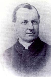
  Comeragh Place Names - Part 1 The study of place names is called “Toponymy” from the Greek words “Tópos” meaning place and “Ónoma” meaning name. The Irish word used is “Logainmneacha” which means the names of the hollows. This may seem a strange word to use, but when you consider that most Irish place names come from the Irish language which evolved from the language of the Celts, and that the early Celts were animal herders who often gathered at watering holes, it may be a most appropriate word to use to describe the study of place names! What`s in a Name? What`s in a name indeed. The Comeraghs, like everywhere else in Ireland, has a variety of place names. The vast majority of the names are gaelic in origin but many have changed over time. We all know how frustrating it can be to peruse place names on a map. What does this mean? Where did that name come from? Here in Waterford we owe a great debt to the amazing Canon Patrick Power from Ballygunner (pic) for the trojan ...
Image
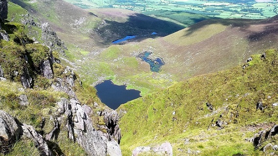
The Boolas Pater Noster/Ribbon Lakes from the Comeragh Plateau A Special Comeragh Place – The Boolas There is no doubt that we humans have special places that affect us in indefinable ways. As Nicholas Crane puts it in his book “The making of the British Landscape” - “We have a predisposition to invest locations with attachments”. Why do we become attached to certain places? Now there`s a sixty-four-thousand-dollar question! Do these places fire our imagination or lift our spirit? Do they help us accept if not understand our place in the cosmos? Howsoever it works, we seem to have a need as humans to switch off from the treadmill of modern life and visit our special places to experience the tranquility and pleasure they give us. It is not surprising to my mind that many of these special places are found in mountains . Mountains have a sense of timelessness and permanence about them that make us all too aware of our own mortality. They seem to speak to our souls and draw us back t...
Image
 Crotty the Robber Rapparees T he word “ropaire” in Irish has come to mean robber but in the late 17th century the term “ropairí” (the verb “ropaim” means I tear) referred to short pike wielding guerrilla fighters who fought on the side of the Jacobites against the Williamites and who continued to harass the forces of the law well into the 18th century. They came to be known as rapparees and loosely they equated to the highwaymen of English tradition of that period. The rapparee was often regarded as a type of social bandit, officially an outlaw but not seen as a criminal by his own community. In fact, many rapparees were admired by the Irish peasants. They were seen as brave opponents of the oppressive colonial system. They were often lauded in verse, think of the song “Brennan on the moor”, praising the deeds of Willie Brennan around the Kilworth mountains. They would often show up at fairs and funerals, sometimes sharing their spoils with members of their community. Were they a...
Image
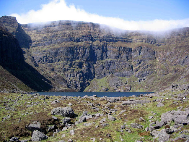
Comeragh Glacial Features  Outside of Kerry and Wicklow, the Comeraghs is one of the most spectacularly glaciated areas in Ireland. The nine square kilometre area of the Central Comeragh Plateau is encircled by no less than nine coums. Surely this makes it one of the most glaciated pieces of real estate in Ireland! Here is some information on some of the glacial features to be found on our local mountains. Dramatic View down to Coumduala from Knockanaffrin Ridge What is a “coum”?  A Coum (“com” in Irish, “corrie” or “coire” in Scots` Gaelic, “cirque” in French and “cwm” in Welsh) is the birth place of a mountain glacier (a river of ice). How old are the Comeragh coums? Hard to be definitive but, according to Frank Mitchell, one of Ireland`s leading authorities on glaciation, most of the ice sculpting was done between about 300,000 and 130,000 years ago with some reshaping in more recent times. How many coums in the Comeraghs? Debatable but there are at least 14. Here go...
Image
Geography, Geology, Geomorphology, Glaciation A Little Geography The Comeraghs stretch from the Suir Valley and Kilsheelan Woods in the north to the Mauma Road in the south, and from Ballymacarbry in the west to Mahon Bridge in the east, and cover an area of almost 200 square kilometres. They are visible from most corners of the county from Clonmel in the north west to Tramore in the south east. The mountains consist of two main ridges - the northern ridge called Knockanaffrin and the southern ridge sometimes called the Monavullagh - separated by the Central Plateau. There are some outlying hills such as Cruachán Déiseach in the south, Cruachán Paorach in the east and Lachtnafrankee in the north-west. The highest point is located on the Central Plateau a little west of Coumshingaun and is simply known as “792”. The range acts as a watershed for the surrounding catchment areas of the Suir Valley to the north and the Waterford coastal plains to the south, with the main streams being the ...